Zorats Karer (Karahunj)
Were the smooth bored holes in dozens of these standing stones deliberate sightlines onto the sky, or features of a burial and settlement site whose astronomical meaning has been read into it after the fact — and how old is the site really?
Why this rating?
- Construction difficulty
- 2/5
- Method uncertainty
- 3/5
- Capability gap
- 2/5
- Open questions
- 4/5
Raising the roughly 200 basalt megaliths (up to ten tonnes) required no exotic technique and is well within known standing-stone practice worldwide, so capability is not seriously in question; what remains genuinely unresolved is the site's chronology and the purpose of the smooth bored holes, for which no tools or workshops have been recovered, while the popular 'oldest observatory' claim is explicitly rejected by mainstream archaeologists and is not used here to inflate the score.
Overview
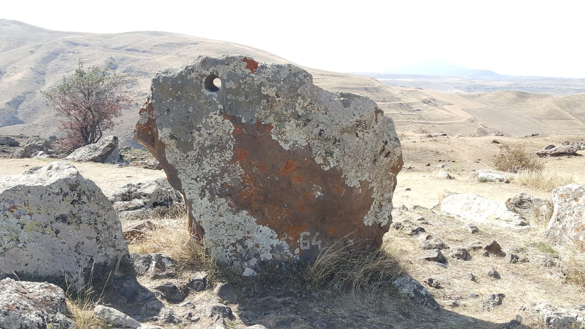
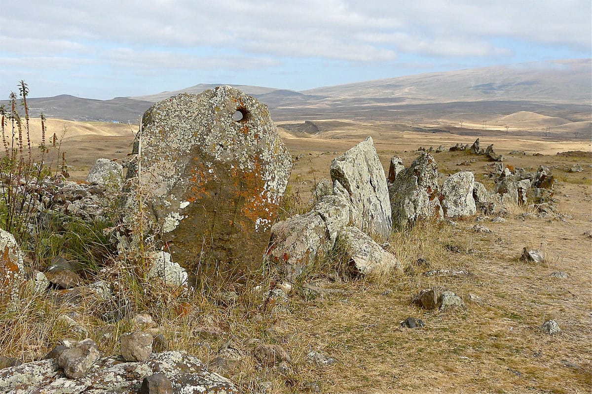
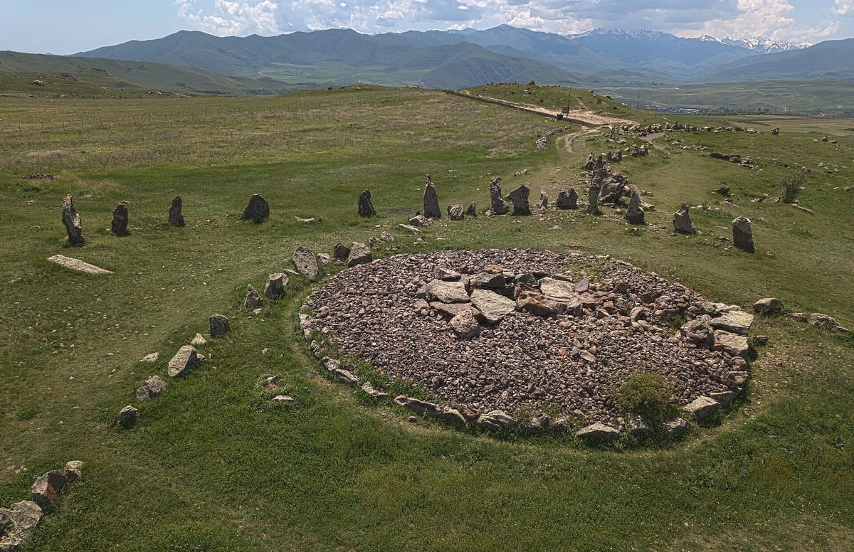
On a stony plateau above the gorge of the Dar River, a few kilometers north of the town of Sisian in Armenia’s Syunik Province, stands a sprawling field of basalt and andesite megaliths known locally as Zorats Karer (“army of stones”) and, in a name popular with visitors, Karahunj or Carahunge. Roughly 223 stones have been registered across the site, standing between half a meter and three meters tall and weighing up to about ten tons. Around 80 of them are pierced by a single, strikingly smooth circular hole, usually near the top of the stone. The site’s central feature is a rough circle of stones roughly 40 meters across, from which a long north-south “arm” of stones and several shorter alignments radiate outward, along with a scatter of isolated menhirs across the surrounding seven-hectare plateau. Excavations have also found stone burial cists and tombs among the megaliths. Popular writing frequently calls the site the “Armenian Stonehenge” and claims it as the world’s oldest astronomical observatory; both labels are attention-grabbing shorthand rather than settled archaeological fact, and this study treats them with the caution they require.
The Structure
Zorats Karer sits at roughly 1,770 meters elevation, commanding wide views over the surrounding highlands. Archaeological surveys — most substantially a 2000 field investigation by a team from the Institut für Vorderasiatische Archäologie at the University of Munich, led by Stephan Kroll — identified the site primarily as a necropolis, with stone-built tombs and burial cists dated mainly to the Middle Bronze Age through the Iron Age (roughly the second millennium BCE into the early first millennium BCE). Kroll’s team also proposed that some of the stone alignments once formed part of a later defensive wall, possibly Hellenistic in date, built largely of rubble and packed earth in which the standing stones served as reinforcing posts. Nearby Sisian’s local museum holds grave goods, including material from a Bronze Age cemetery of more than 200 shaft graves, that fits this broader picture of the plateau as a long-used burial landscape rather than a single-purpose monument raised in one campaign. The stones themselves are unworked or lightly worked basalt and andesite boulders, sourced locally, set upright directly into the ground; the famous holes, roughly 4–5 cm in diameter and up to about half a meter deep, are cut cleanly through the stone and are the site’s most distinctive and most argued-over feature.
How Was It Built?
Raising the megaliths themselves required no exotic technique: the stones are set upright in pits or packed sockets, a method attested at standing-stone sites worldwide from the Neolithic onward, achievable with earthen ramps, levers, and ropes and modest labor for stones in this size range (up to about ten tons). What has no settled explanation is how, when, and why the smooth bored holes were cut. No tools, workshops, or debris directly documenting the hole-boring process have been recovered, and there is no local tradition of similar perforated standing stones elsewhere in the Caucasus to compare the technique against. A further complication: on many of the holed stones, the smooth interior surface of the hole shows less weathering than the surrounding exterior stone face, which some researchers take as a sign the holes could be more recent modifications, added well after the stones were first erected, rather than a single original design element datable to the megaliths’ initial construction.
The Mainstream View
The archaeological consensus, anchored in the 2000 University of Munich survey and subsequent Armenian scholarship, treats Zorats Karer as a genuine and significant prehistoric monument — but fundamentally a burial and, in part, later fortification site rather than a purpose-built scientific instrument. Its Bronze Age–to–Iron Age dating places its main use no earlier than roughly 2000 BCE, contemporary with or later than Stonehenge rather than thousands of years before it, undercutting comparisons that trade on the site’s supposed extreme antiquity. Armenian archaeologists have pushed back firmly on the observatory framing: Pavel Avetisyan of Armenia’s National Academy of Sciences has bluntly dismissed the “ancient observatory” label as, in his words, “elementary charlatanism.” Archaeoastronomer Clive Ruggles, one of the field’s most respected specialists, has likewise cautioned that rigorous archaeoastronomical method does not support the strong claims made for the site, noting that similarly ambitious observatory readings of Stonehenge itself have largely been abandoned by scholars, making the comparison “less than helpful” rather than illuminating.
The Open Case
The observatory hypothesis has real, if contested, origins: Soviet archaeologist Onnik Khnkikyan first proposed in 1984 that the perforated stones served astronomical purposes, astrophysicist Elma Parsamian later reported apparent alignments between certain holed stones and the summer solstice sunrise and sunset, and radiophysicist Paris Herouni pushed the claim furthest, arguing in the 1990s for a construction date around 5500 BCE and a role as a working solar and stellar observatory — conclusions most archaeologists regard as unsupported by the excavated evidence and not corroborated by independent dating. This study presents the observatory idea only as a disputed hypothesis, not an established fact: no one has recovered tools, sighting devices, or construction contexts that would confirm the holes were deliberately, precisely aimed at celestial events rather than serving some other function — or arising from a mix of practical use and coincidental alignment. What remains genuinely open, without invoking anything beyond ordinary prehistoric human activity, is more modest but still real: the precise chronology of the site (whether all the stones and holes belong to one period or accumulated across many centuries of reuse), the original purpose of the bored holes themselves, and how a Bronze Age–Iron Age burial ground came to include this particular, unusual architectural feature at all. Those are open questions for further excavation and analysis, not evidence of lost technology or non-human builders.
Sources
Gallery