Carnac Stones
Why did a pre-literate Neolithic society raise more than 3,000 stones into converging rows stretching for kilometers near Carnac, and was the plan ceremonial, calendrical, territorial, or all three at once?
Why this rating?
- Construction difficulty
- 3/5
- Method uncertainty
- 2/5
- Capability gap
- 2/5
- Open questions
- 5/5
Quarrying and raising techniques (sledges, rollers, socketed pits) are standard, well-documented Neolithic megalith methods, so how it was built is not especially mysterious. What remains one of prehistoric archaeology's most debated open questions is why: whether the converging, height-graded rows served calendrical, ceremonial, or territorial purposes, and whether they were raised in one campaign or accumulated over a millennium.
Overview
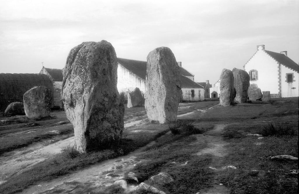
Near the small town of Carnac on the south coast of Brittany, in north-west France, stands the largest concentration of megalithic standing stones anywhere in the world. More than 3,000 menhirs — upright blocks of local granite, some over 4 meters tall — are arranged in long parallel rows known as alignments, accompanied by dolmens (stone-chambered tombs), tumuli (earthen burial mounds), and freestanding stone circles. The main alignments were raised by Neolithic communities over a long span of time, most estimates clustering between roughly 4500 and 3300 BCE, making them older than Stonehenge and contemporary with, or older than, Egypt’s earliest pyramids. In July 2025, UNESCO inscribed the wider site — the Carnac alignments together with more than 550 related monuments spread across 28 towns and villages in the Morbihan department, covering some 1,000 square kilometers — as a World Heritage Site, the first entirely in Brittany. The people who built Carnac left no writing, so everything known about why they built it is reconstructed from the stones, the soil around them, and the objects buried nearby.
The Structure
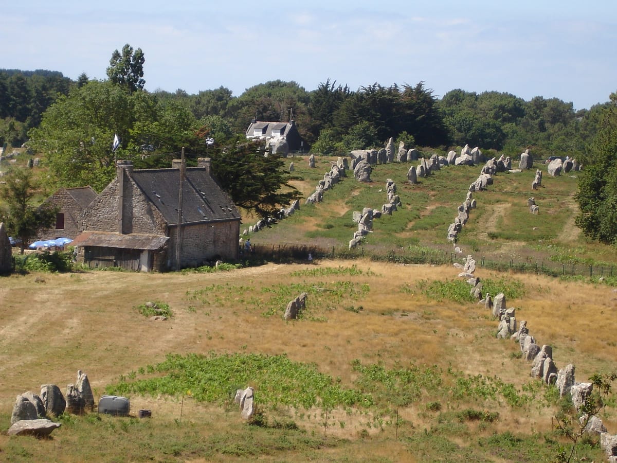
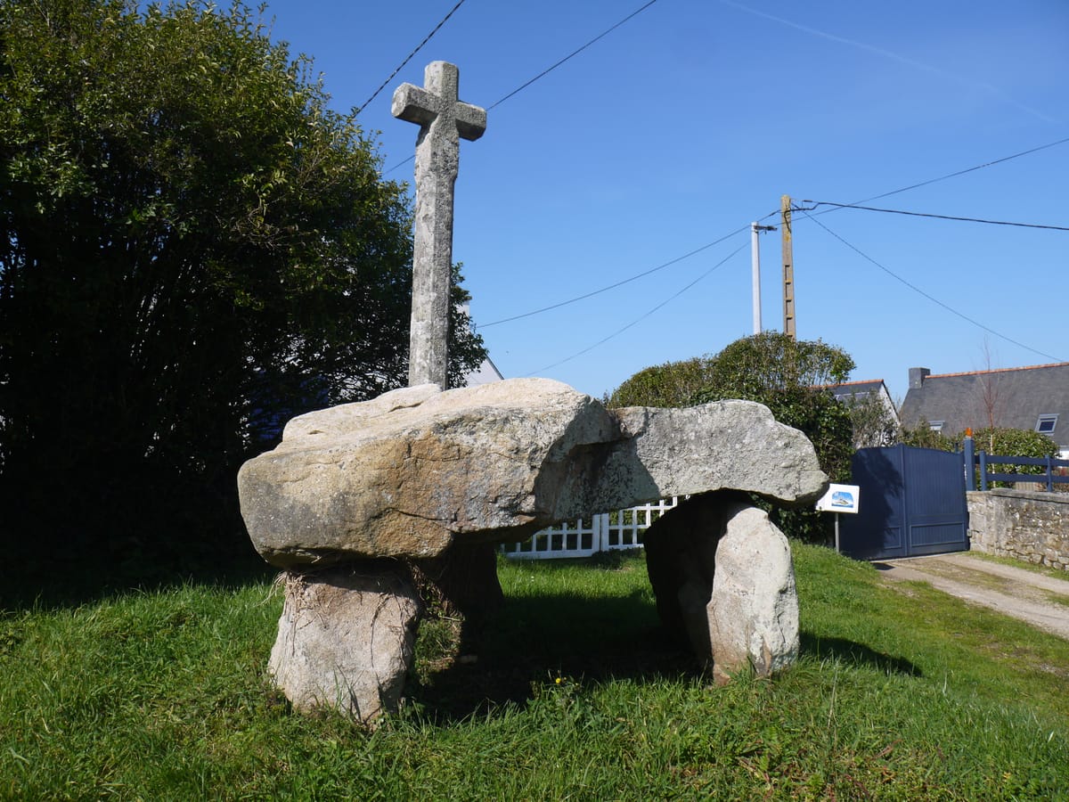
Carnac’s fame rests on three principal groups of alignments, laid out over roughly four kilometers. The Ménec alignment, the westernmost and largest, comprises about 1,099 stones in 11 converging rows stretching some 1,165 by 100 meters, opening into a stone circle (cromlech) of roughly 70 blocks at its western end. The stones here are tallest — around 4 meters — near that circle and diminish gradually to about 0.6 meters toward the eastern end. East of Ménec, the Kermario alignment fans out across roughly 1,300 meters in ten columns of about 1,029 stones, again anchored by a stone circle. Further east still, the Kerlescan alignment adds 555 stones in 13 lines over about 800 meters, with its own circle of 39 stones. Beyond the rows, the Carnac landscape holds substantial funerary monuments: the Saint-Michel tumulus, a mound roughly 125 by 60 meters at its base and 12 meters high, built from an estimated 35,000 cubic meters of earth and stone; the tumuli of Tumiac and Mané-er-Hroëk; and numerous dolmens, including Kercado, Crucuno (roofed by a single capstone of about 40 tonnes), and smaller tombs like Cruz-Menquen, later topped with a Christian cross. Grave goods recovered from these tombs — polished stone axeheads of jade sourced from the Italian Alps, and ornaments of callaïs (a turquoise-like mineral) imported from south-western Iberia — show that the society that built Carnac was linked into trade networks stretching across much of Neolithic Western Europe.
How Was It Built?
The menhirs were quarried from local granite outcrops, in many cases within a few kilometers of where they now stand, exploiting natural fractures in the rock to split large blocks without metal tools. Moving stones weighing many tonnes across uneven terrain is generally understood to have relied on wooden sledges, rollers, and ropes, hauled by large coordinated groups of people; raising them upright likely involved digging a sloped pit or socket, tipping the stone into it using ramps and levers, and packing the base with rubble and smaller stones to hold it in position — techniques broadly consistent with megalith-building practices documented elsewhere in Neolithic Europe. What is less settled is the pace and organization of the work: whether the alignments as seen today were laid out largely in one sustained campaign, or accumulated gradually over centuries as generations of smaller groups added rows, stones, and monuments to an existing sacred landscape. After more than 70 years without major subsurface investigation, French archaeologists resumed excavation and geophysical survey of the Carnac alignments in the mid-2020s, and this renewed fieldwork continues to refine the dating and reveal buried features — postholes, older stone settings, and structures — beneath and around the visible rows.
The Mainstream View
Archaeologists agree that Carnac was built and reworked by Neolithic, pre-Celtic communities native to Brittany, most likely as part of an evolving ceremonial and funerary landscape rather than a single monument raised to a fixed design. The mainstream reading treats the alignments as serving overlapping purposes: territorial markers asserting a community’s claim to land, processional routes linking settlements to the tombs and tumuli of ancestors, and gathering places for periodic ritual or funerary activity, paralleling the broader European pattern in which megaliths mark identity, memory, and connection to the dead. The dating window itself, spanning well over a thousand years across different excavation results, is read as evidence that Carnac was not a single building project but a landscape that Neolithic communities returned to, added to, and reused over an extended period. A well-known local Christian legend holds that the stones are pagan Roman soldiers turned to stone by Pope Cornelius (venerated locally as Saint Cornély) as they pursued him — a folk tale reflected in the later Christianizing of some dolmens with crosses, but understood by historians as legend rather than any record of the monument’s actual origin or purpose.
The Open Case
What remains genuinely unresolved is not that Carnac exists or roughly when it was built, both well established by decades of excavation and, more recently, renewed geophysical survey, but why its builders chose such an unusual form: long, precisely converging rows of stones graded by height, repeated at three separate sites along the same stretch of coast, rather than a single circle, tomb, or enclosure. Proposed explanations range from calendrical or astronomical schemes — the surveyor Alexander Thom argued in the 1970s that Carnac’s alignments encoded solar and lunar observations and a standardized “megalithic yard,” a claim that remains statistically contested and is not accepted as settled fact — to purely ceremonial processional avenues, to territorial displays of community labor and identity with no observational function at all. How the work itself was organized is equally open: whether a single sustained campaign raised the bulk of the stones, or whether the alignments grew in stages across centuries as different groups contributed rows or extensions, is not resolved by the current dating evidence, which spans more than a millennium. None of this requires anything beyond Neolithic communities operating with sophisticated but low-technology methods; it is the sheer scale, repetition, and deliberate geometry of the rows, still being re-examined by archaeologists today, that keeps the true purpose of Carnac an open question.
Sources
- Wikipedia — Carnac stones
- UNESCO World Heritage Centre — Megaliths of Carnac and of the shores of Morbihan
- Centre des Monuments Nationaux (menhirs-carnac.fr) — History of the Carnac Alignments
- Ministère de l'Europe et des Affaires étrangères — UNESCO inscription of the Megaliths of Carnac and of the shores of Morbihan
Gallery