Vardzia Cave Monastery
Medieval Georgian workers hollowed an entire hidden town of hundreds of interconnected rooms, churches, and cellars into a sheer cliff face, complete with a working irrigation system and concealed tunnel access — so how was a project of this scale planned, sequenced, and kept livable, and how much of the original complex still lies buried behind the section the 1283 earthquake tore open to the sky?
Why this rating?
- Construction difficulty
- 3/5
- Method uncertainty
- 2/5
- Capability gap
- 2/5
- Open questions
- 3/5
Subtractive rock-cutting into soft tuff, including a gravity-fed aqueduct with precise gradients, is well within demonstrated medieval Georgian capability and comparable to other Caucasus rock-cut sites, so the main open questions concern scale and organization — how much of the complex the 1283 earthquake destroyed or still hides, and the day-to-day logistics of a project with no surviving building records — rather than unresolved technique.
Overview
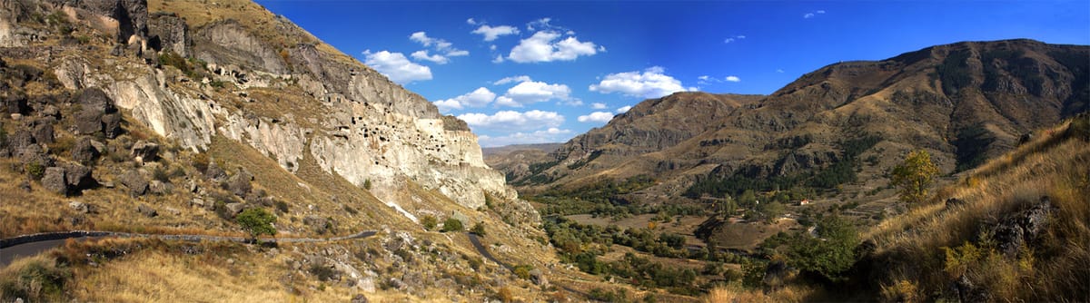
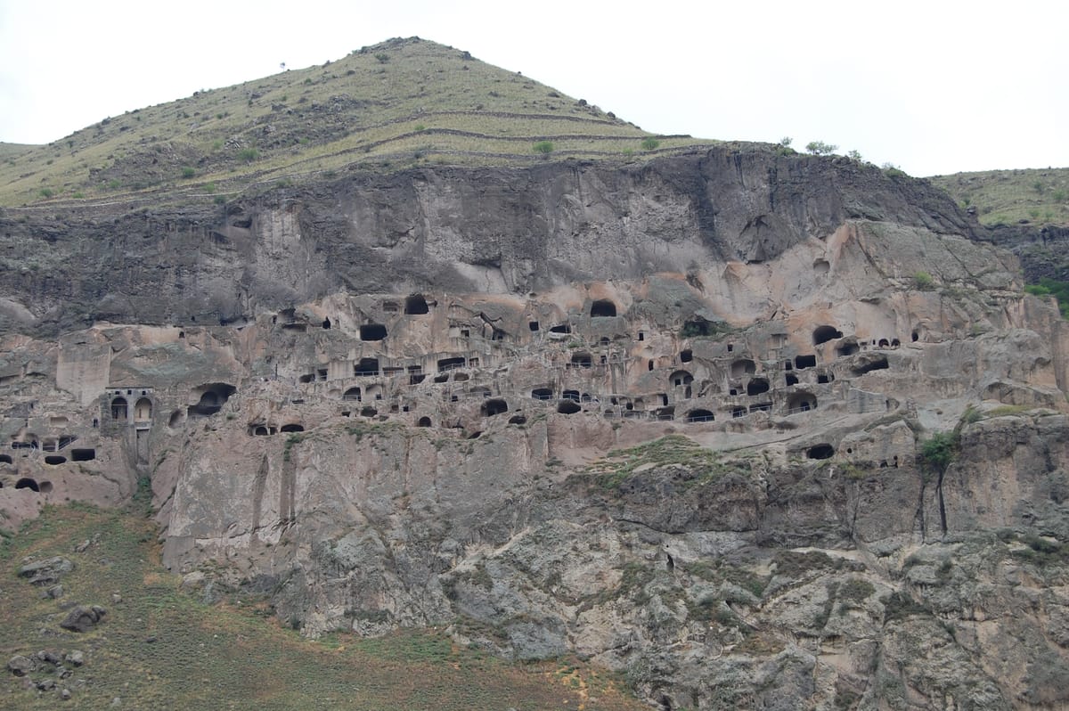
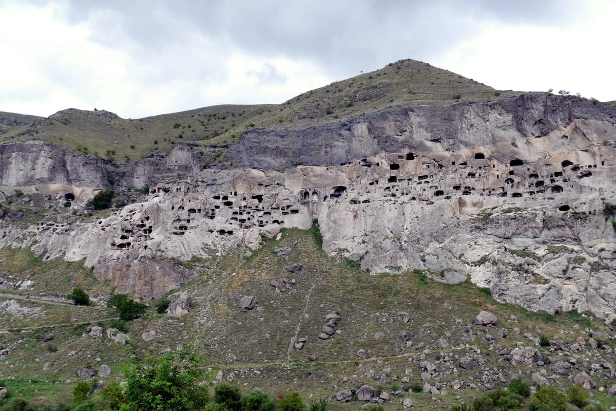
Above the Kura (Mtkvari) River in southern Georgia, the cliffs of Erusheti Mountain hold one of the great rock-cut settlements of the medieval world: Vardzia, a cave monastery and hidden town carved directly into the mountainside. What began in the 1150s under King George III as a defensive and monastic foothold grew, under his daughter Queen Tamar, into a sprawling complex of several hundred surviving interconnected chambers spread across many tiers of the cliff face — dwellings, a richly frescoed church, wine cellars, bakeries, a forge, and a gravity-fed irrigation and water-supply system. Vardzia was built to be unseen: its entrances were originally hidden behind a screen of rock and reached through concealed tunnels rather than open stairways, so that from the river valley below the mountain looked untouched. That concealment ended in 1283, when a powerful earthquake sheared away a large section of the outer cliff face, collapsing part of the complex and exposing the honeycomb of rooms that visitors see today. Vardzia sits within the broader Vardzia-Khertvisi area, which has been on Georgia’s UNESCO World Heritage Tentative List since 2007, recognized both for its rock-cut architecture and for its place in the Georgian Golden Age.
The Structure
Construction unfolded in phases across roughly half a century. Georgian chronicles and later scholarship place the founding of Vardzia under King George III (r. 1156-1184), initially as cave dwellings and a fortified refuge on Georgia’s southern frontier. After his death, his daughter and successor, Queen Tamar — under whom Georgia reached its medieval political and cultural peak — greatly expanded the site, and the complex’s centerpiece, the Church of the Dormition, was carved and decorated during her reign. The rock-cut town eventually reached across roughly 500 metres of cliff face and multiple tiers of galleries, containing several hundred rooms recorded by modern surveys — dwellings, monastic cells, a refectory, bakeries with ovens, a forge, a pharmacy, and around two dozen wine cellars, some with wine jars still sunk into their floors. A gravity-fed aqueduct, several kilometers long, carried water into the complex, feeding cisterns and irrigation channels that supported both daily life and agriculture on the terraces below. The Church of the Dormition, roughly 8 by 14 metres and about 9 metres high, is decorated with murals depicting the life of Christ and donor portraits of George III and Tamar presenting a model of the church — among the most important surviving examples of Georgian medieval mural painting. Vardzia functioned simultaneously as monastery, fortress, and town: a place of worship and retreat that also anchored the kingdom’s defenses along the upper Mtkvari valley. In 1283, a major earthquake struck the region, collapsing the outer rock screen that had concealed much of the complex and destroying an unknown portion of the site; a fourth building phase followed as survivors patched and partly rebuilt what the quake had exposed and damaged, but Vardzia never regained its earlier scale, and reported room counts vary between sources — reflecting how much of the original complex was lost to the earthquake, later erosion, and centuries of exposure.
How Was It Built?
Vardzia was excavated subtractively out of tuff — a comparatively soft, workable volcanic rock — rather than assembled from cut or quarried blocks. Georgian builders and monastics cut galleries, rooms, and stairways directly into the cliff using hand tools, working the rock from the inside out level by level, so that dwellings, chapels, and storage rooms could be linked internally by tunnels, stepped passages, and small connecting holes rather than exposed exterior paths. This approach served a defensive purpose as much as a practical one: by leaving the outer rock face largely intact and routing access through hidden tunnels, the builders kept the settlement invisible from the valley floor, a design choice consistent with Vardzia’s dual role as refuge and monastery on a contested frontier. The engineering extended well beyond the living spaces themselves — the aqueduct and internal channels that supplied water throughout the complex required precise gradients and routing carved into the same rock, letting a community of unknown but clearly substantial size sustain itself, including its wine production, entirely inside the mountain. No contemporary Georgian building plan or engineering treatise for Vardzia survives; the sequence and logistics of the excavation are reconstructed from the finished galleries themselves, from comparison with other Georgian rock-cut sites, and from the layered building phases visible in the stonework and in the church’s frescoes.
The Mainstream View
Historians and archaeologists agree on the essential outline: Vardzia is a medieval Georgian rock-cut monastery and fortified settlement, begun under King George III and substantially enlarged under Queen Tamar during the Georgian Golden Age of the 12th and early 13th centuries, built using iron tools to carve dwellings, a church, and support facilities directly out of the mountain’s tuff. The identification of the site with these two rulers rests on donor portraits in the Church of the Dormition itself, on Georgian chronicle sources, and on stylistic dating of the murals, and is not seriously disputed. The techniques required — subtractive rock-cutting, gravity-fed water engineering, and the deliberate concealment of entrances behind an intact outer rock screen — are well within the demonstrated capabilities of medieval Georgian masons and monastic communities, and comparable rock-cut monasteries exist elsewhere in Georgia and the wider Caucasus and Byzantine world. The 1283 earthquake is likewise treated as settled history: regional seismic activity of this kind is well documented, and the exposed, roofless character of much of the surviving complex is explained as the visible result of that quake tearing away the concealing rock face rather than evidence of any different origin.
The Open Case
What remains genuinely open at Vardzia is not who built it or roughly when, but the finer texture of how a project this large was actually organized and lived in, and how much of it survives to be studied. Sources differ meaningfully on the number of rooms and tiers that made up the complex at its height — a real discrepancy that likely reflects both the destruction wrought by the 1283 earthquake and the difficulty of surveying a site where large sections have collapsed, been buried, or eroded away over eight centuries. The precise logistics of the excavation — how work crews were organized and supplied, how ventilation, lighting, and structural stability were managed while cutting deep into a cliff face, and how the irrigation system’s gradients were surveyed and maintained without modern instruments — are inferred from the finished galleries rather than documented directly, since no building records survive. And because a substantial share of Vardzia’s original footprint is thought to have been destroyed or buried by the earthquake and subsequent centuries, it remains a real, actively studied question just how much of this hidden city — its full extent, its unexcavated chambers, and the day-to-day life once sustained entirely inside a mountain — still waits behind the rock that is visible today. These are questions of scale, engineering, and lost record-keeping, not of anything beyond skilled human work by a wealthy, technically capable medieval kingdom.
Sources
Gallery